How AI is Helping Cities Combat Extreme Heat

Extreme heat is becoming a more frequent and dangerous problem for cities worldwide. With record-breaking temperatures on the rise, urban heat islands exacerbate this issue, impacting vulnerable communities the most.
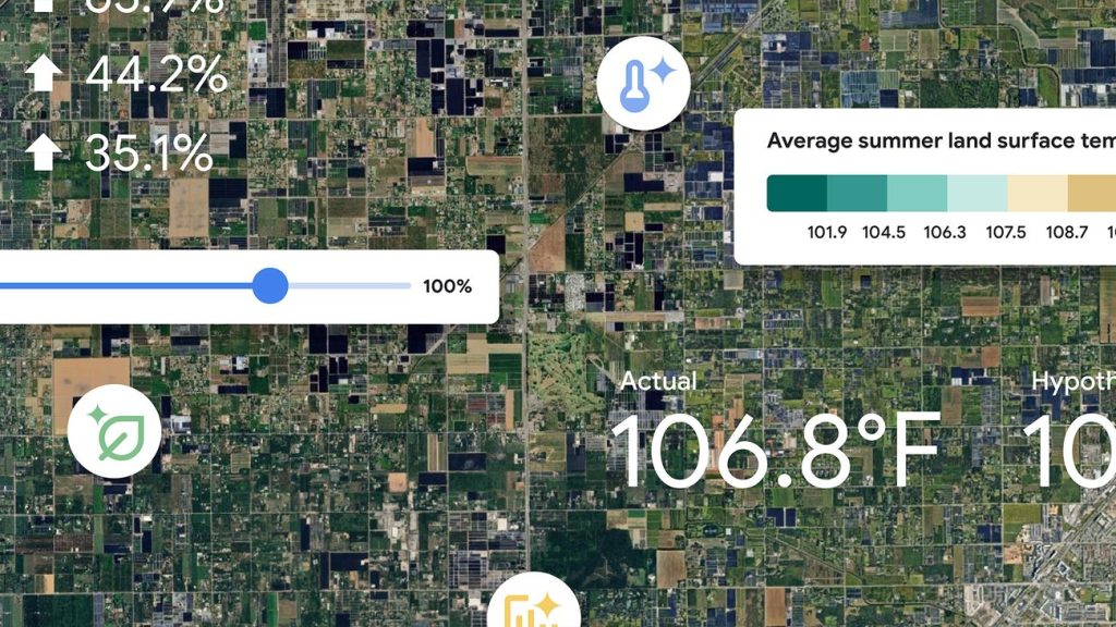
To address this, new AI-driven tools are being developed to help cities identify hot spots and implement effective cooling strategies. One such innovation is the Heat Resilience tool, which uses satellite and aerial imagery to guide urban planners in making data-driven decisions.
A New AI Tool to Help Cities Make Informed Decisions
Quantifiable data is crucial for cities to identify their hottest, most vulnerable communities and prioritize cooling interventions. The Heat Resilience tool employs AI-powered object detection and other models to assess local characteristics like green space and roof reflectivity.
This tool is currently being piloted in 14 U.S. cities, where officials use it to pinpoint the most heat-vulnerable neighborhoods and plan accordingly. Insights provided by the tool allow city planners to see the impact of cooling interventions down to the neighborhood level.
The Need for Cooling Strategies
Heat islands cause cities to heat up at twice the global average rate. This is especially harmful to older adults, children, and individuals with chronic health issues.
Heat-related mortality for people 65 and older increased approximately 85% between 2017 and 2021. Cooling strategies are essential to protect these at-risk communities and ensure public health.
Therefore, cities must implement measures like planting trees and installing cool roofs to mitigate these effects.
How AI Informs Urban Planning
The Heat Resilience tool helps cities make impactful changes by providing detailed insights.
For example, Miami-Dade County is using the tool to develop policies that incentivize developers to take heat mitigation measures.
Stockton, California, has used an earlier version of the tool to gather data for projects aimed at reducing urban heat islands.
Pilot Programs and Future Plans
Fourteen U.S. cities are currently piloting the Heat Resilience tool. These pilot programs help gather valuable feedback and data to refine the tool further.
Officials in these cities use the tool to identify vulnerable neighborhoods and devise tailored cooling strategies. Insights gained from these pilots will inform future updates and expansions of the tool.
The Role of Satellite and Aerial Imagery
The use of satellite and aerial imagery is a game-changer in understanding urban heat islands. These images provide a comprehensive view of city landscapes and help identify areas that need urgent attention.
By analyzing these images, the Heat Resilience tool can pinpoint hot spots where interventions will be most effective.
This technology enables cities to prioritize their efforts and resources efficiently, ensuring maximum impact.
Community Impact and Benefits
Implementing AI-driven cooling strategies can significantly improve the quality of life in urban areas. These measures not only reduce temperatures but also enhance public health and safety.
Communities become more resilient to extreme heat, leading to safer and healthier living environments.
Ultimately, these interventions contribute to creating sustainable and livable cities for future generations.
The Future of AI in Urban Heat Management
AI offers a promising solution to the growing problem of urban heat. As the technology advances, it will become even more effective in helping cities tackle extreme heat.
Partnerships with more cities and continuous improvements to tools like the Heat Resilience tool will be crucial in this endeavor.
By leveraging AI, cities can make informed decisions to combat rising temperatures effectively.
The Heat Resilience tool is a significant step towards creating safer, healthier, and more sustainable urban environments.


